COSY CORNER BEACH
Cosy Corner is a free camping area located in the Bay of Fires region of northeast Tasmania, offering private spots and a picturesque coastal experience. While it is a basic, self-sufficient camping location, it provides a beautiful, natural setting to enjoy the area, very popular in the summer. Cosy Corner is part of the Bay of Fires Conservation Area on the far northeast coast of Tasmania. The Bay of Fires stretches fifty kilometers along the northeast coast of Tasmania, featuring white sandy beaches, pristine blue waters, and large granite boulders covered in striking orange lichen.
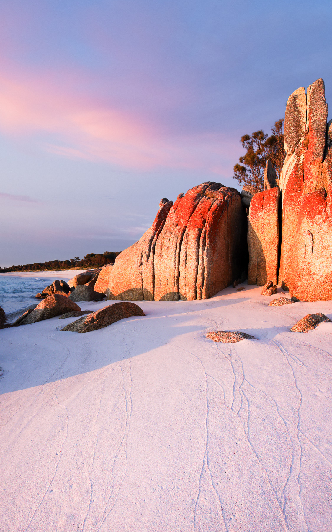
Cosy Corner Beach - Anne Carroll
LAKE BURBURY REFLECTIONS
Lake Burbury is a man-made lake on Tasmania's west coast, created in the early 1990s for hydro-electricity production. Located near Queenstown and surrounded by the Franklin-Gordon Wild Rivers National Park, it is a popular spot for fishing, especially for brown and rainbow trout, and offers other recreational activities like boating and camping. Anne loves photographing reflections.
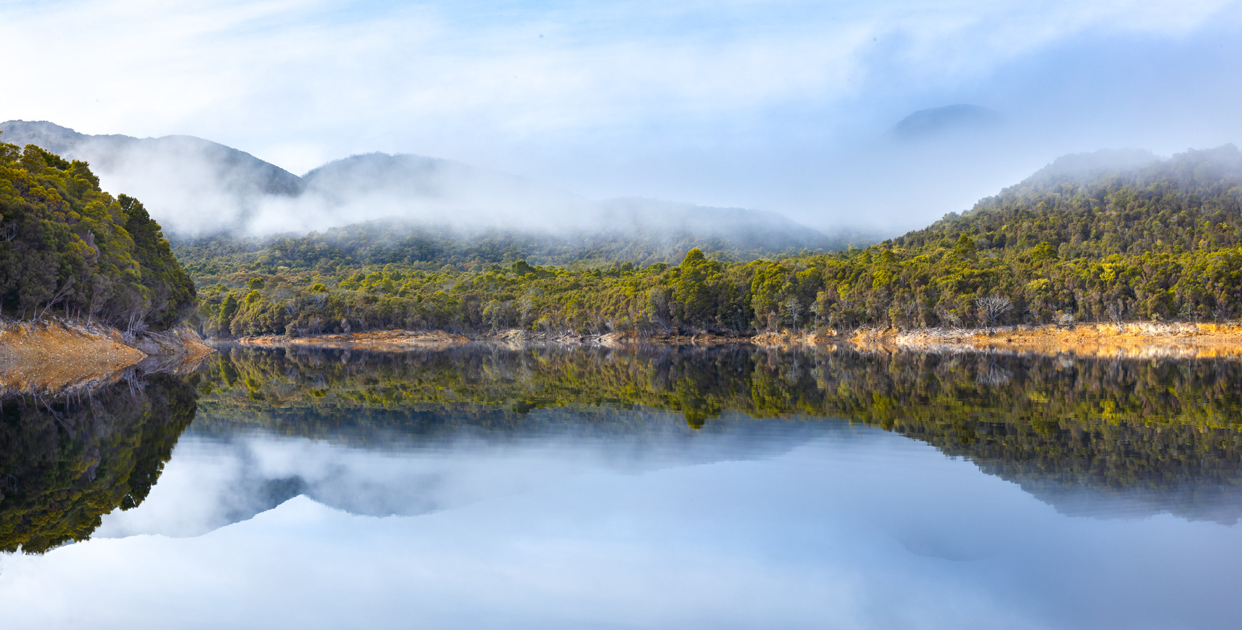
Lake Burbury Reflections - Anne Carroll
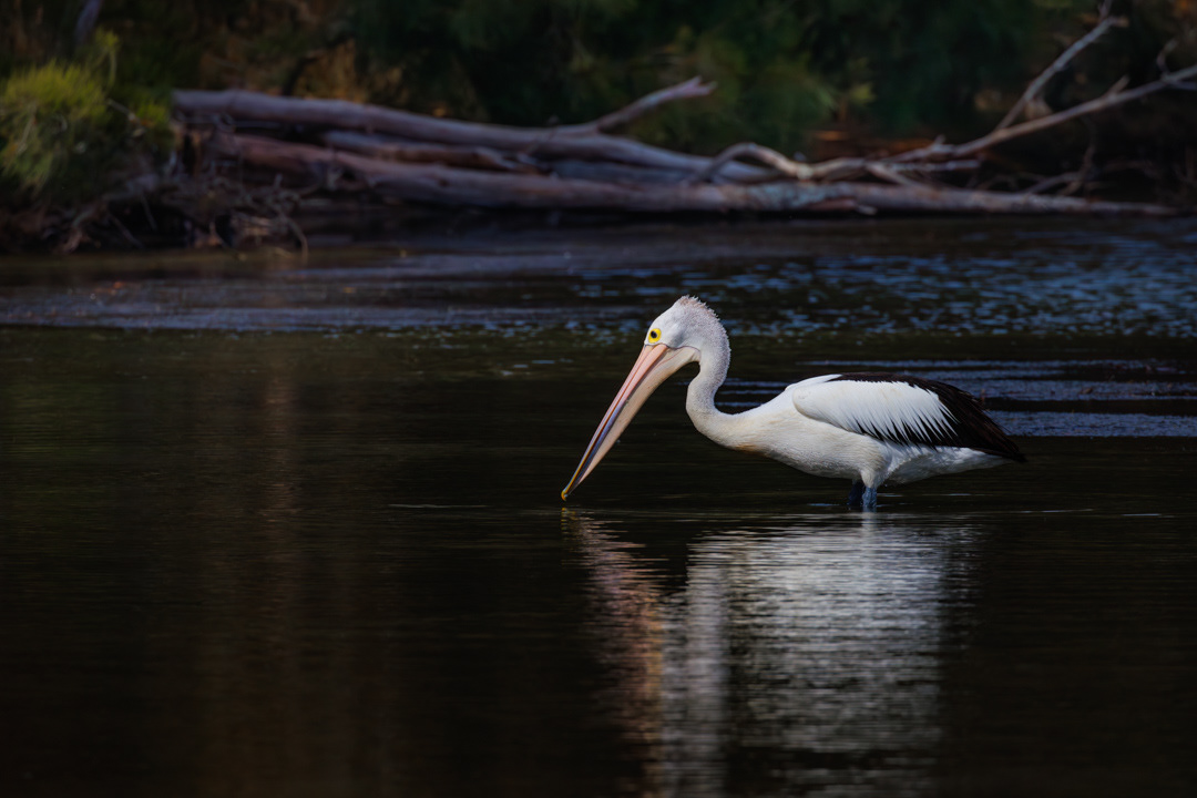
MY PELICAN
Anne Carroll found this pelican at Binalong Bay. They are a common and beloved sight there often seen near the boat ramp and along the shoreline.
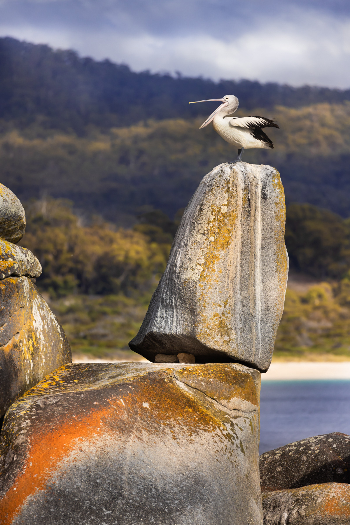
My Pelican - Anne Carroll
TASMANIA
A man is fishing from the public jetty by the old Dunalley Bay Distillery on the Denison Canal. Just metres upstream this canal is crossed by a road swing bridge, which is electrically-operated, and carries the Tasman Highway over the Canal. The canal and bridge cut across the East Bay Neck isthmus, allowing small vessels to avoid the long and often hazardous voyage around the Tasman Peninsula to reach Hobart.
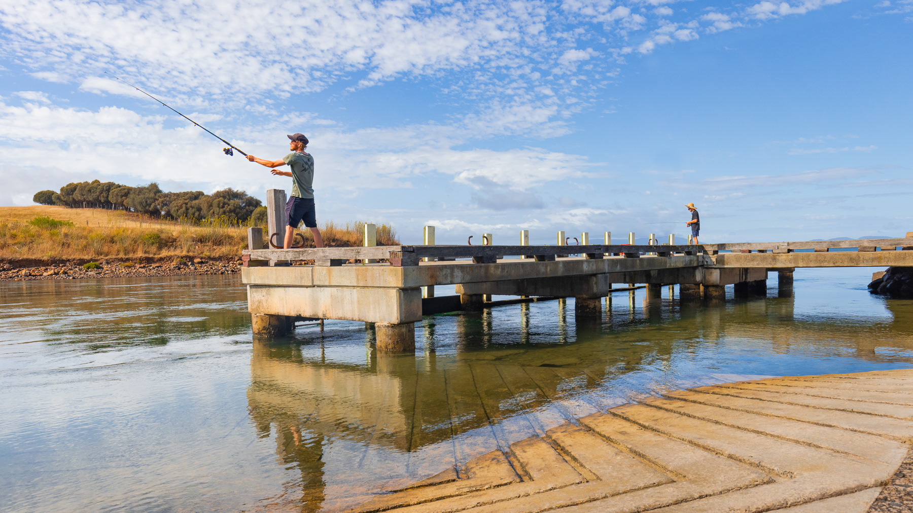
Tasmania - Anne Carroll
SHERBROOKE
Sherbrooke Creek Beach is a hazardous beach located near Princetown, known for its steep slope off the sandy beach, strong rips, and powerful surf, making it very unsuitable for swimming. Lives have been lost here. It is situated at the mouth of the Sherbrooke River, and is walking distance of about a kilometer from the Loch Ard Gorge car parking area. While dangerous for swimming, it offers scenic views and can be an enjoyable part of a walk along the coast.
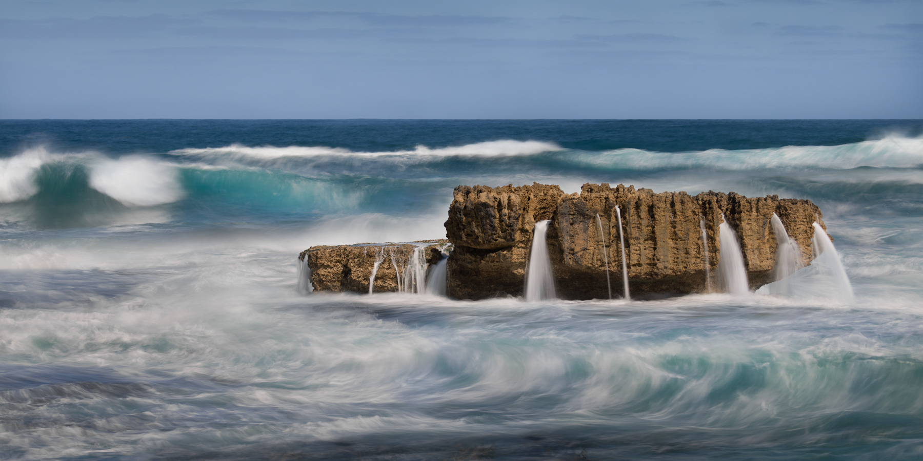
Sherbrooke - Anne Carroll
GIBSONS BEACH
This shore is probably my most loved of all Australian beaches. Also known as Gibson Steps, located near Princetown, this beach is located at the base of 86 steps carved into a dramatic limestone cliff, offering stunning views of the coastline and offshore stacks named Gog and Magog. One can access the beach for walks and photos, but swimming can be dangerous due to strong currents. The area is often temporarily closed to public access due to high tides and rough seas. Rockfalls can occur.
Gibsons Beach - Anne Carroll
AFTER THE SAND GROOMER.
Sand grooming at Brighton Beach involves artificial sand replenishment and erosion control measures. The beach is cleaned mechanically and maintained with actions include trucking in sand, creating sandbag walls, and implementing other erosion management works to protect the bathing boxes and shorelines. On this morning a lone beachgoer was enjoying the solitude.
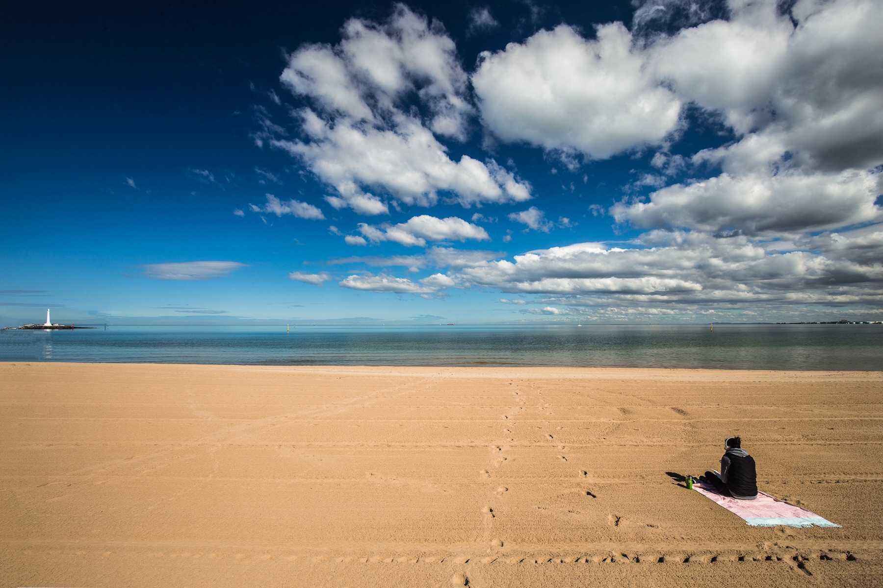
After the Sand Groomer - Frank Carroll
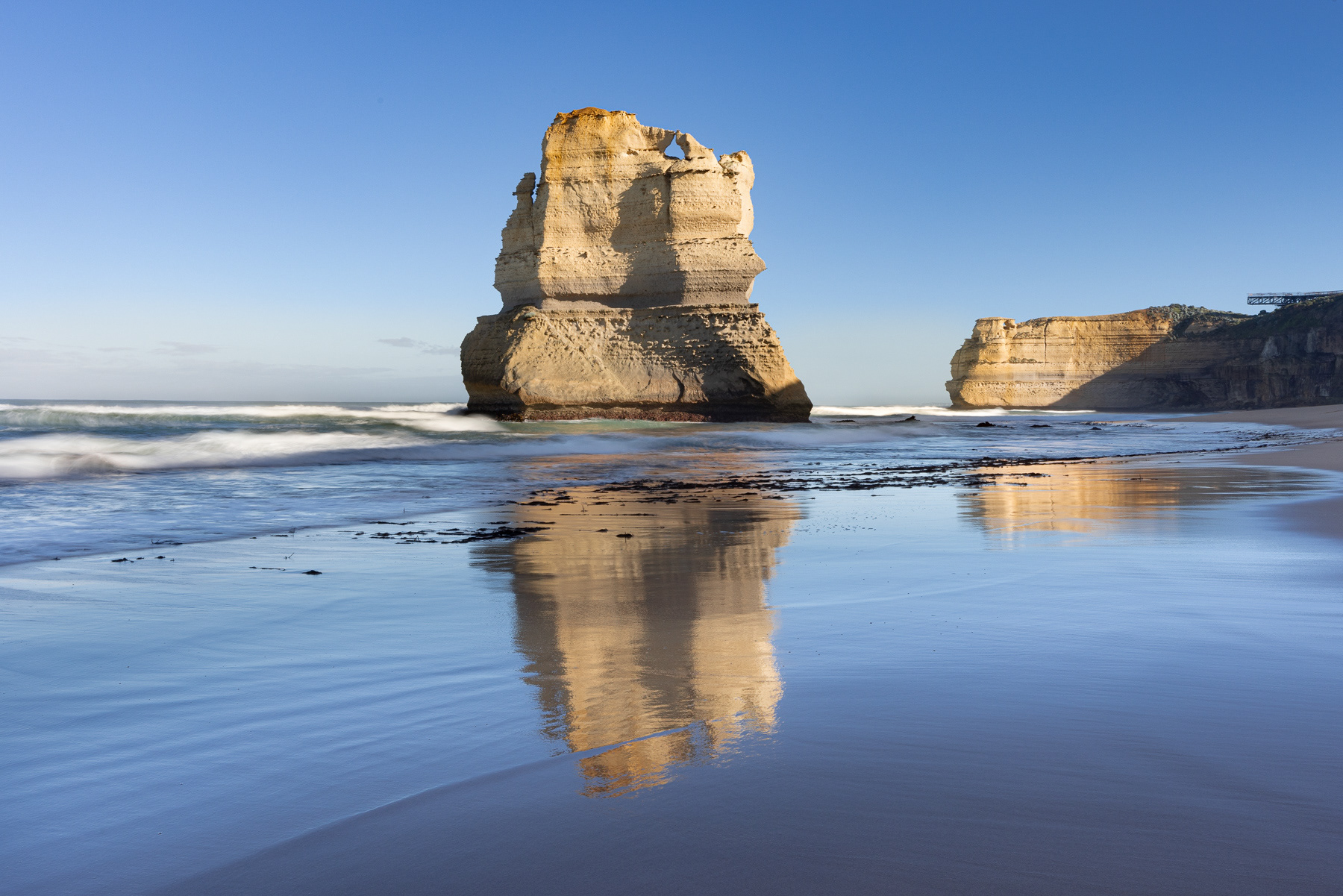
GOG AND MAGOG
European and other folktales created a tradition around the two giants Gog and Magog, but in our Australian context the story of "Gog and Magog" relates to the geological formations on Australia's Shipwreck Coast, which were named after the traditional figures. The name was given by European explorers to the rock stacks found at the foot of Gibson’s Steps in the Twelve Apostles National Park. These rock stacks, part of the dramatic limestone cliffs, were formed over millions of years by ocean waves. European explorer George Bass initially named them "The Sow and Piglets," with nearby Mutton Bird Island as "The Sow" and the smaller stacks (which are now called Gog and Magog) as "The Piglets".
Gog and Magog - Frank Carroll
WINTON WETLANDS
In 1971, the natural Winton Swamp was dammed to create Lake Mokoan, an off-line water storage for the River Murray. The creation of the lake involved flooding thousands of hectares of agricultural land, ancient forests, and the original wetlands, which resulted in the death of around 200,000 river red gums. Lake Mokoan was intended for agricultural irrigation and provided economic and recreational value, but it was plagued by issues such as high water loss through evaporation. Lake Mokoan was decommissioned and drained in 2010.
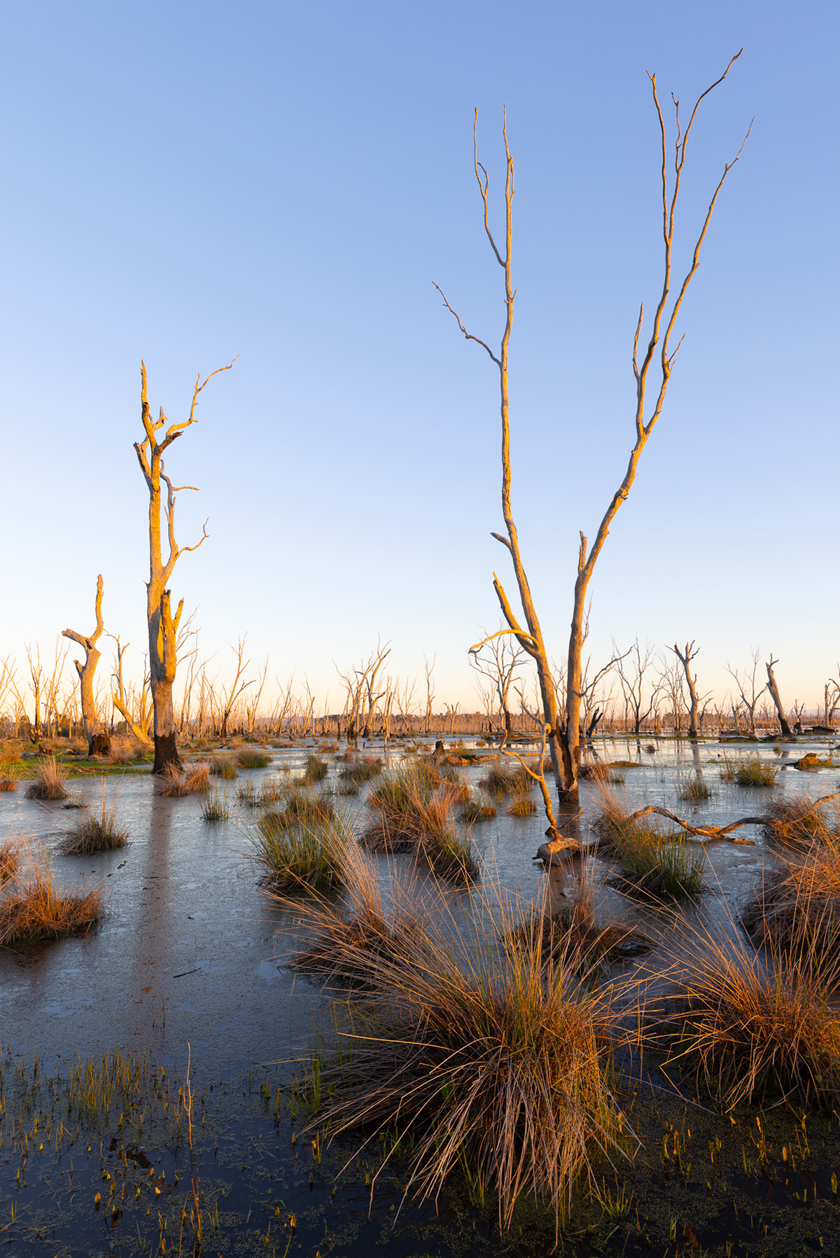
Winton Wetlands - Frank Carroll
HOPETOUN FALLS
”I travelled by rail to Beech Forest from where I proceeded to visit the Hopetoun Falls and was more than repaid for my labour in getting there by the beautiful scenery. The natural basin in solid rock at the foot of the falls, fringed with luxuriant ferns, the loveliest species the forest produces, filled me with delight. In a while I came to a clearing where I met an old gentleman who was having timber felled, in order to erect a house. The day being warm, I asked him if I could get a drink of water. He answered in the affirmative, producing at the same time a bottle the contents, of which, he said, was a very good medicine and which he always liked to use to counteract any evil effect the water, however good, might produce upon a person. I had no objection to the "medicine" when I read the label, Old Mull. After allaying my thirst, I had a long chat with the old gentleman. Next day I booked my passage for Melbourne by the “S.S. Dorset.”
(Colac Herald - April 25, 1902)
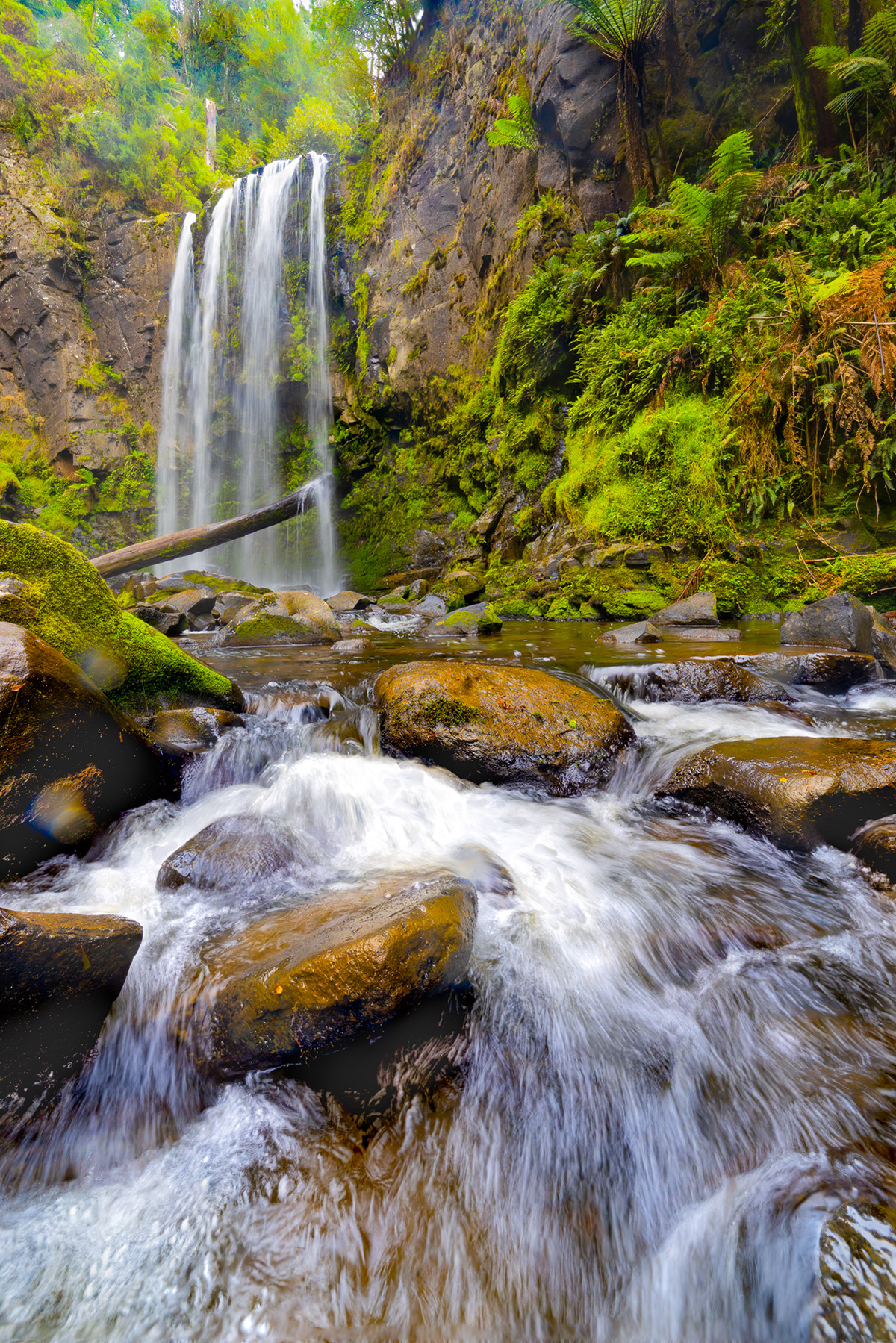
Hopetoun Falls - Frank Carroll
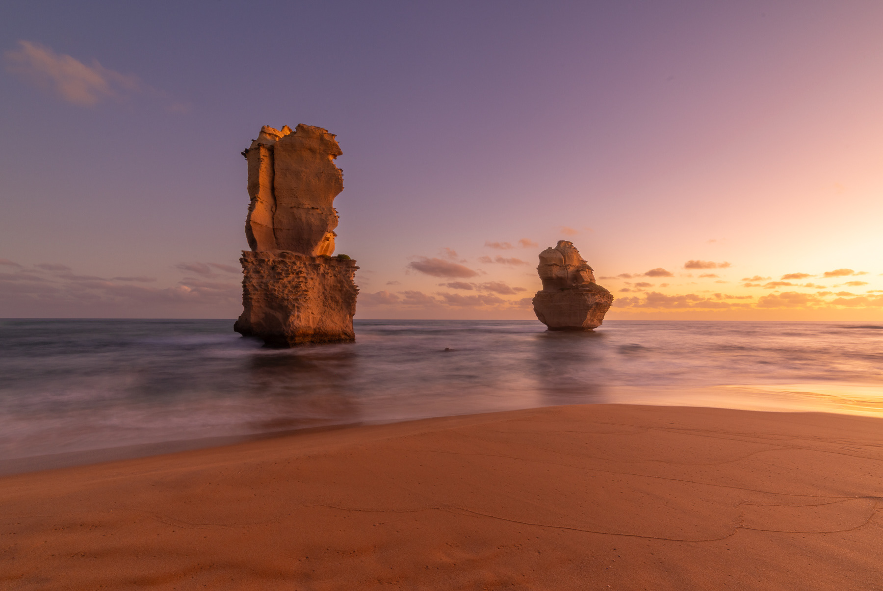
VIEW FROM THE SADDLE
From the saddle area before the construction of the new lookout at the Twelve Apostles, the view to the west was the iconic, classic panorama of the sea stacks, featuring the famous rocky structures in the distance. This saddle lookout faced the main apostles giving a broader view of the coastline and the main group of sea stacks, with the view toward the west becoming more prominent especially for photography.
This is the classic view, showing the most famous and iconic view of the Twelve Apostles to the west, where you can see most of the remaining sandstone stacks.
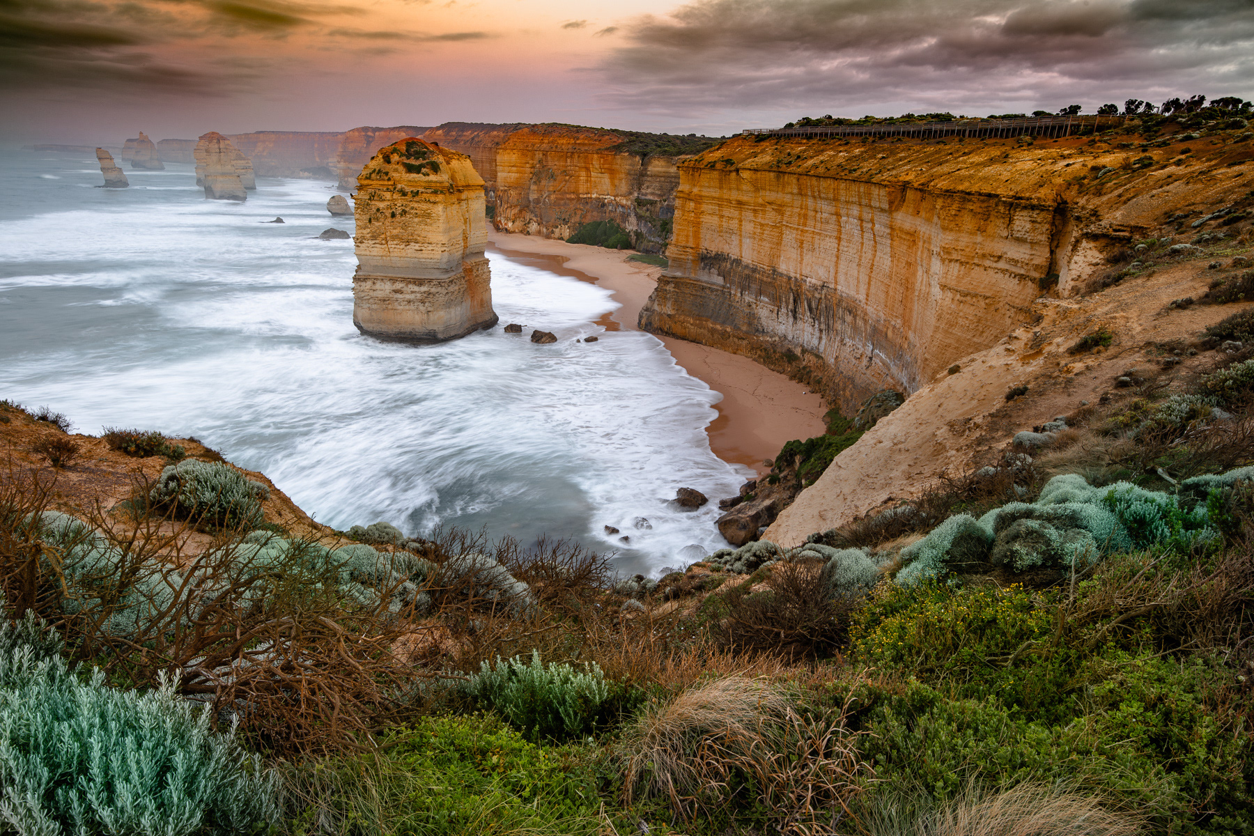
View from the Saddle - Frank Carroll
MOUNT PARIS DAM
The Mount Paris Dam, originally called the Morning Star Dam, was built in 1936 in northeast Tasmania to supply water for the Mt Paris Tin Mine. Constructed largely by hand during the Great Depression, with more than seventy men employed on its construction, it is the only surviving slab and buttress dam of its kind in Tasmania. After the mine closed in 1970, the dam was emptied, and in 1985, a large hole was blasted through its wall to allow the Cascade River to flow naturally again.
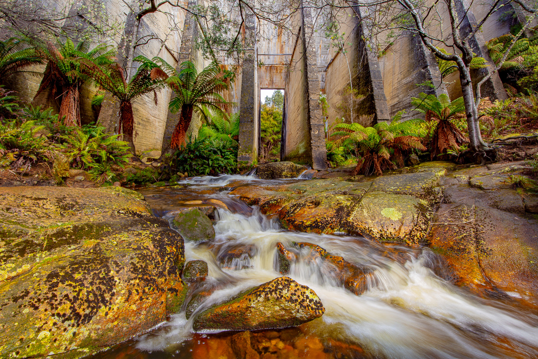
Mount Paris Dam - Frank Carroll
MOONSET AT DAWN
European and other folktales created a tradition around the two giants Gog and Magog, but in our Australian context the story of "Gog and Magog" relates to the geological formations on Australia's Shipwreck Coast, which were named after the traditional figures. The name was given by European explorers to the rock stacks found at the foot of Gibson’s Steps in the Twelve Apostles National Park. These rock stacks, part of the dramatic limestone cliffs, were formed over millions of years by ocean waves. European explorer George Bass initially named them "The Sow and Piglets," with nearby Mutton Bird Island as "The Sow" and the smaller stacks (which are now called Gog and Magog) as "The Piglets".
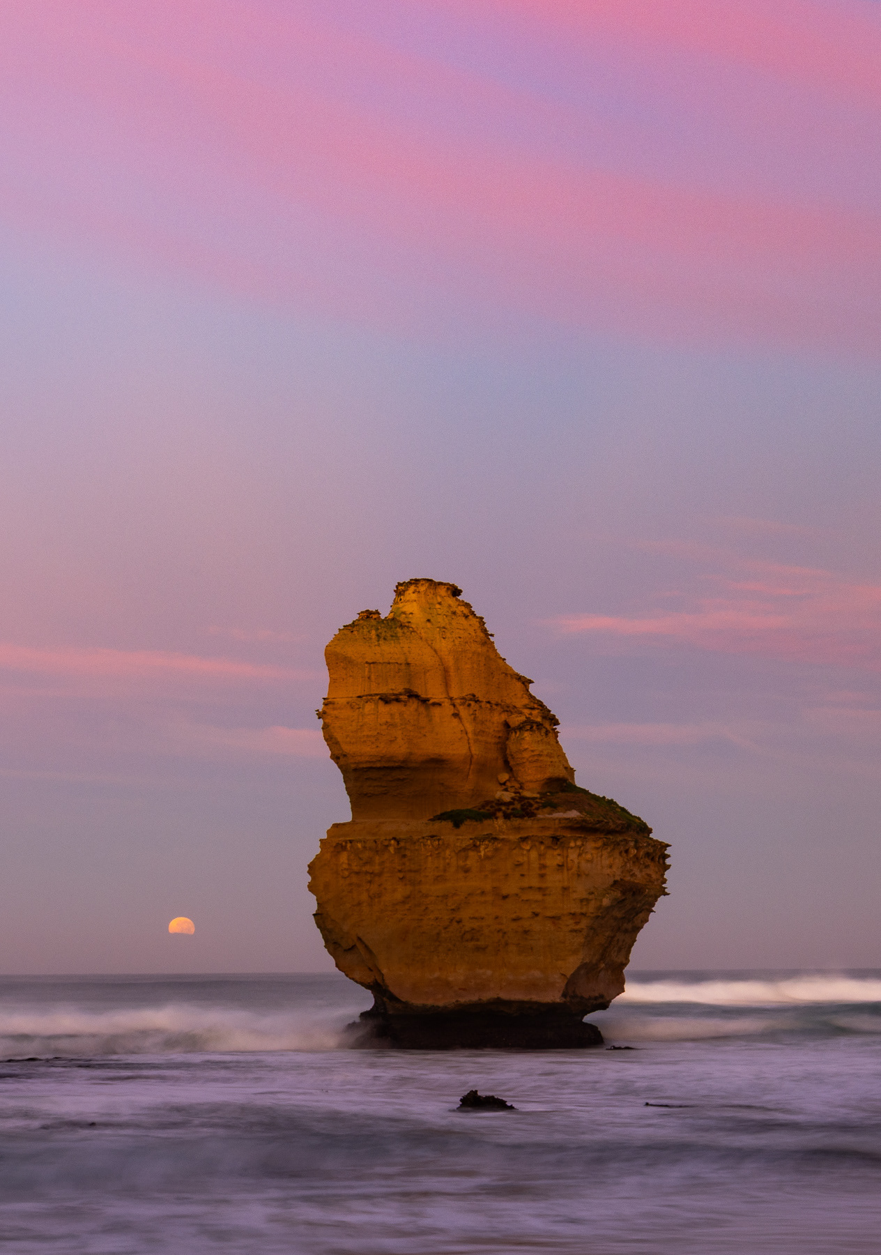
Moonset at Dawn - Frank Carroll
QUEENSCLIFF LIFEBOAT HOUSE
The Queenscliff lifeboat house and jetty are part of a historic maritime complex that once played a vital role in the safety of ships entering and leaving Port Phillip. The "Steamer Pier" (built 1884) is the current pier with a lifeboat shed from 1926-1929. Today, the lifeboat the Queenscliffe is displayed at the nearby Queenscliffe Maritime Museum along with other artefacts, while the pier is a popular spot for walking and fishing.
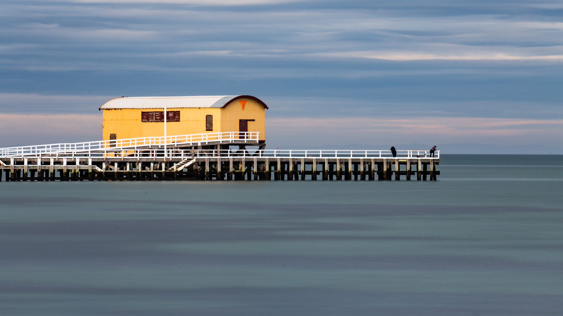
Queenscliff Lifeboat House - Frank Carroll
WALLAGA LAKE PELICAN
The Djiringanj people tell a story about a greedy pelican named Gurung-gubba who would steal fish from the people. When Captain Cook’s ship, the Endeavour, appeared on Australia’s horizon its large white sails resembled the pelican, and this caused the people confusion and fear. They thought it might be a returning megafauna from the Dreaming, and they feared it might take everything from them.The Djiringanj people are the traditional custodians of the Wallaga Lake area.
Wallaga Lake Pelican - Anne Carroll